MetropolisRoadNetwork
Author: Lucas Javaudin
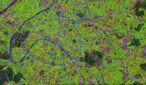
This tool allows you to import a road network from various format (OpenStreetMap, HERE, TomTom) into a format that is compatible with METROPOLIS2.
Metro-TRACE
Author: Romuald Le Frioux
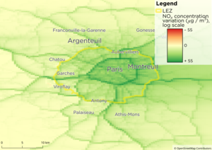
This tool allows you to compute fuel consumption, emissions of global pollutants (CO2) and emissions of local pollutants (NOx, PM2.5, CO) from the results of a simulation. The tool can also compute the dispersion of the local pollutants and the exposure of the population to those pollutants.
COMING SOON
MetropolisNetworkSplit
Authors: Théotime Kuhn & Lucas Javaudin
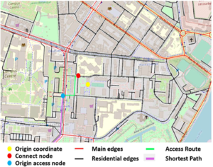
This tool splits a road network in two parts: a main part composed of the most used roads and a secondary part composed of the remaining roads. The METROPOLIS2 simulator can then be run on the main part only, for a shorter computing time, while still considering the secondary part to allow agents to travel back and forth the main part of the network and their origins and destinations.
COMING SOON